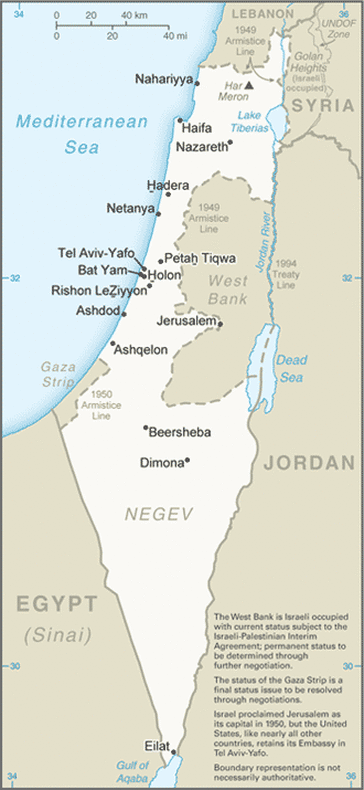
This is a country sized map of Israel.
Total area: 20,770 sq km
Land Area: 20,330 sq km
Water Area: 440 sq km
Size Comparative to U.S. Territory: a bit larger than New Jersey
Total Distance of Land Boundaries: 1,017 km
Total Distance of Coastline: 273 km
Climate: balmy and dry in eastern and the southern areas; temperate
Terrain: Jordan Rift valley; low coastal plain; mountainous; in the south, Negev desert
Point of Highest Elevation: Har Meron 1,208 m
Point of Lowest Elevation: Dead Sea -408 m
